Peru – Cordillera Blanca – “Porque está ahí”.

“Because it’s there.” – George Mallory

6AM. Sun rises. We stroll trough an awakening Huaraz. It’s extremely busy as usual. By the time we reach Jaime’s shoe repair shop, our senses have run overtime. Colourful locals splurge on empenadas, mariscos, pollo a la brasa, chifa, papas rellenas, jugos naturales. Quechua Indians surely have heavy stomachs, even in these wee hours. Huaraz is not the most attractive city (it has been completely rebuilt after the massive landslides in the wake of the 1970 earthquake), but its bustling, Andean athmosphere with the mezmerizing backdrop of the Cordillera Blanca, will keep you hypnotized for well a while.

Gearing up at Jaime's shoe repair shop in Central Huaraz. Ancash, Peru.

Gearing up at Jaime’s shoe repair shop in Central Huaraz. Ancash, Peru.

We just came down from the Yurac Yacu community where we teached kids and adults basic computer skills, so we gasp for some adventure. We sort out all gear for a 10-day assault on some carefully, selected Peruvian peaks. The plan is plain and simple: freshen up some mountaineering skills, acclimitise on some 5000m peaks and do an attempt on 6032m Toclaraju. As reported before, the season is not as it is supposed to be (and isn’t so for a couple of years now), so we cancelled the initial plan to climb Chopicalqui, after the unfortunate dead of 2 Peruvian guides on Alpamayo early in the season and reports of avalanche danger and waist-deep snow near Chopi’s summit.

Hambre amigo? Breakfast is the most important meal of the day. Huaraz. Peru.

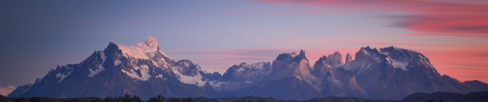
The Cordillera Blanca is a compact range of only 180km stretching north to south, forming a barrier for the Amazon moisture, causing a desert-like effect stretching towards the west (Cordillera Negra), forming the highest, glaciated, tropical range in the world (9° south of the Equator!). It has 25 peaks over 6000m (20000feet) of which Huascaran (6768m) is the highest. The range is known for its excellent climbing conditions and ease of access.

Flores de senecio on the way towards Yanapaccha basecamp. Huascaran National Park. Cordillera Blanca. Peru.

Flores de senecio on the way towards Yanapaccha basecamp. Huascaran National Park. Cordillera Blanca. Peru.

Jaime cooks the most delicious food in our makeshift 4900m high base camp (under our MSR Twing tarp), while Roger's hunger builds up.

Jaime cooks the most delicious food in our makeshift 4900m high base camp (under our MSR Twing tarp), while Roger’s hunger builds up.

Once again we team up with our friend and guide Roger Reyes and his brother Jaime for a perfect outing. We met Roger in our first trip in Northern Peru in 2008 and since then have climbed together and became close friends to the family. I have set up a website to connect hikers and climbers directly to the guide, as it is well known that guides are underpaid by agencies in Huaraz. So grab yourself a sustainable bargain, if you’re looking for any form of climbing or expedition support in the Blanca or Huayhuash.

Knot and rope technique rehearsels. Yanapaccha basecamp. Cordillera Blanca. Peru.

Knot and rope technique rehearsels. Yanapaccha basecamp. Cordillera Blanca. Peru.

Practice makes perfect. Yanapaccha (5460m) plays hide and seek in the fickle weather. Cordillera Blanca. Peru.

Practice makes perfect. Yanapaccha (5460m) plays hide and seek in the fickle weather. Cordillera Blanca. Peru.

Our first objective is Yanapaccha, at the head of the LLanganuco Valley, well-known for its twin lake and a popular day excursion from Huaraz. We leave in the lousy taxi of Señor Zorro de la Montaña (the mountain fox). It would soon become clear why. The road up to the popular lakes and Portachuelo Llanganuco Pass (our drop-off towards basecamp) is a complete disaster. In Huaraz there is a strong call for government investment in the Huascaran National Park, making it more accessible for tourism, but all money flows to the southern gringo trail, which attracts 90% of tourists in Peru.

Yanapaccha base camp makes for excellent training grounds. Ice walls on the glaciers nearby. Manageble crevasses. Boulders and rockwalls. And a technical climb to its summit for desert. Cordillera Blanca. Peru.

Yanapaccha base camp makes for excellent training grounds. Ice walls on the glaciers nearby. Manageble crevasses. Boulders and rockwalls. And a technical climb to its summit for desert. Cordillera Blanca. Peru.

Up you go. Climb that ice, baby! Yanapaccha glacier. Cordillera Blanca. Peru.

Up you go. Climb that ice, baby! Yanapaccha glacier. Cordillera Blanca. Peru.

Your turn, amigo! Yanapaccha glacier. Cordillera Blanca. Peru.

Your turn, amigo! Yanapaccha glacier. Cordillera Blanca. Peru.

Preparing crevasse rescue. Yanapaccha summit (5460m) top left.  Cordillera Blanca. Peru.

Preparing crevasse rescue. Yanapaccha summit (5460m) top left. Cordillera Blanca. Peru.

Although the weather stays cold and lousy for the time of the year, we enjoy ourself to the fullest. We cover an array of essential skills. Mountain hazards on snowpeaks, rope team travel, climbing knot techniques, belay systems, self arrest, top rope management, vertical ice climbing, full crevasse rescue techniques. What a luxury to have Jaime cooking excellent, fresh food at this altitude. Time flies by and before we know it, we’re on Yanapaccha’s summit mushroom enjoying the Blanca’s highest peaks around us.

Hang me out to dry! Having fun in a crevasse of  Yanapaccha's glacier. Cordillera Blanca. Peru.

Hang me out to dry! Having fun in a crevasse of Yanapaccha’s glacier. Cordillera Blanca. Peru.

Uuuuuuuunnnnnggg. No honey you are not too heavy, but if you ask me to pull you out of the ice... Yanapaccha glaciar .Cordillera Blanca. Peru.

Uuuuuuuunnnnnggg. No honey you are not too heavy, but if you ask me to pull you out of the ice… Yanapaccha glaciar .Cordillera Blanca. Peru.

Well, there are less hostile places on earth to enjoy a holiday. Yanapaccha glaciar .Cordillera Blanca. Peru.

Well, there are less hostile places on earth to enjoy a holiday. Yanapaccha glaciar .Cordillera Blanca. Peru.

Finally out of the abyss! Yanapaccha glaciar .Cordillera Blanca. Peru.

Finally out of the abyss! Yanapaccha glaciar .Cordillera Blanca. Peru.

 Thank you, good night! Yanapaccha basecamp. Cordillera Blanca. Peru.

Thank you, good night! Yanapaccha basecamp. Cordillera Blanca. Peru.

Around 6AM, at around 5200m,  the first rays of light makes the first 65° wall towards the summit more visible. On all fours. Up it is. Nevado Yanapaccha (5460m). Cordillera Blanca. Peru.

Around 6AM, at around 5200m, the first rays of light makes the first 65° wall towards the summit more visible. On all fours. Up it is. Nevado Yanapaccha (5460m). Cordillera Blanca. Peru.

The quadruple summit of Nevados Huandoy (center pyramid is 6395m) and right the popular Nevado Pisco Oeste (5752m), which we climbed in 2008. Shot from the upper slopes on Yanapaccha. Cordillera Blanca. Peru.

The quadruple summit of Nevados Huandoy (center pyramid is 6395m) and right the popular Nevado Pisco Oeste (5752m), which we climbed in 2008. Shot from the upper slopes on Yanapaccha. Cordillera Blanca. Peru.

Reaching the summit ridge of Nevado Yanapaccha (5460m). Cordillera Blanca. Peru.

Reaching the summit ridge of Nevado Yanapaccha (5460m). Cordillera Blanca. Peru.

After a technical, nightly climb, we made the summit of Yanapaccha (5460m) on the morning of the 4th of July. From left to right: Chopicalqui (6354m), Huascaran Sur (6768m) and Huascaran Norte (6555m). Cordillera Blanca. Peru.

After a technical, nightly climb, we made the summit of Yanapaccha (5460m) on the morning of the 4th of July. From left to right: Chopicalqui (6354m), Huascaran Sur (6768m) and Huascaran Norte (6555m). Cordillera Blanca. Peru.

The Nevados Huandoy group (left), Nevado Pisco (center right) and Nevado Piramide (5885m) to the right. Shot from under the summit ice mushroom of Yanapaccha (5460m). Cordillera Blanca. Peru.

The Nevados Huandoy group (left), Nevado Pisco (center right) and Nevado Chacraraju Oeste (6112m) to the right. Shot from under the summit ice mushroom of Yanapaccha (5460m). Cordillera Blanca. Peru.

Back in basecamp after  a fluent climb. Yanapaccha (5460m). Cordillera Blanca. Peru.

Back in basecamp after a fluent climb. Yanapaccha (5460m). Cordillera Blanca. Peru.

All we need! Crunchy, guacamole sticks with tea and coffee. Life is good. Thanks Jaime! Yanapaccha (5460m). Cordillera Blanca. Peru.

All we need! Crunchy, guacamole sticks with tea and coffee. Life is good. Thanks Jaime! Yanapaccha (5460m). Cordillera Blanca. Peru.

Huge stands of Thamnolia Vermicularis lichen, on the way down from base camp. Sampling for the Adventure & Science project. LLanganuco lakes far below. Huascaran National Park. Cordillera Blanca. Peru.

Huge stands of Thamnolia Vermicularis lichen, on the way down from base camp. Sampling for the Adventure & Science project. LLanganuco lakes far below. Huascaran National Park. Cordillera Blanca. Peru.

After 4 days on Yanapaccha, we move towards Ishinca valley. We climb up Urus Este (5420m) in good weather and hope that weather will hold for an attack on 6032m Toclaraju. It’s strange, it’s mountaineering high season, and Ishinca base camp is almost empty. Not even 5 groups around us. A Slovakian team just returned from the summit of Toclaraju. They are exchausted and unhappy. Conditions were bad above 5800m, lots of snow and only clouds and wind. They achieved summit but didn’t have any views. They long for a shower and hot bed in Huaraz. As more clouds roll in, we weigh our chances and the next morning the weather is shitty. Or we climb to high camp or we cancel our bid and put our bets on another 5000m peak. Ishinca (5530) wins. Mind games. The day after. We climb Ishinca in perfect conditions while bad weather swallows Toclaraju. Back in Huaraz, we hear more bad news. Our 2 Argentine neighbours in basecamp, which I spoke to the day before on the go or no go for Tocla, choose to climb to high camp of Toclaraju. An avalanche ended their dreams on their next day bid on our intended route. Mind games. Respect them mountains. May they rest in peace.

If you’re on facebook, we have a page now where I update pictures on a regular basis.

Regrouping for part 2. Ishinca Valley. Fickleness in the weather continues. Cordillera Blanca. Peru.

Regrouping for part 2. Ishinca Valley. Fickleness in the weather continues. Cordillera Blanca. Peru.

Unusual, few teams in Ishinca basecamp (4400m). Cordillera Blanca. Peru.

Unusual, few teams in Ishinca basecamp (4400m). Cordillera Blanca. Peru.

Over boulder fields towards the glaciar of Urus Este(5420m). From left to right: Ishinca (5530m), Ranrapalca (6162m), Ocshapalca (5881m) and Vallunaraju (5686m). Cordillera Blanca. Peru.

Over boulder fields towards the glaciar of Urus Este(5420m). From left to right: Ishinca (5530m), Ranrapalca (6162m), Ocshapalca (5881m) and Vallunaraju (5686m). Cordillera Blanca. Peru.

Climbing up Urus Este (5420m), while clouds swallow our next objective Tocllaraju (6032m). Cordillera Blanca. Peru.

Climbing up Urus Este (5420m), while clouds swallow our next objective Tocllaraju (6032m). Cordillera Blanca. Peru.

Amigo Roger and Katrijn on the summit of Urus Este(5420m). Azure Laguna Akilpo below. Cordillera Blanca. Peru.

Amigo Roger and Katrijn on the summit of Urus Este(5420m). Azure Laguna Akilpo below. Cordillera Blanca. Peru.

Alpenglow on the cloudy, fluted west wall of Tocllaraju (left, 6032m). The aim was to climb to high camp the next day. Once again bad weather would set in and ruin our plans. Cordillera Blanca. Peru.

Alpenglow on the cloudy, fluted west wall of Tocllaraju (left, 6032m). The aim was to climb to high camp the next day. Once again bad weather would set in and ruin our plans. Cordillera Blanca. Peru.

Dark falls over Tocllaraju (6032m) and Ishinca (5530m) basecamp. Cordillera Blanca. Peru.

Dark falls over Tocllaraju (6032m) and Ishinca (5530m) basecamp. Cordillera Blanca. Peru.

Alpine splendisism around Ishinca high camp (5000m). Ranrapalca (6162m) north face. A 1km high mixed line of ice and granite. Cordillera Blanca. Peru.

Alpine splendisism around Ishinca high camp (5000m). Ranrapalca (6162m) north face. A 1km high mixed line of ice and granite. Cordillera Blanca. Peru.

Last patches of flora at 5000m altitude. Huascaran National Park. Cordillera Blanca. Peru.

Last patches of flora at 5000m altitude. Huascaran National Park. Cordillera Blanca. Peru.

Urus Este (5420m) as seen from Ishinca high camp.  Cordillera Blanca. Peru.

Urus Este (5420m) as seen from Ishinca high camp. Cordillera Blanca. Peru.

“The mountains are calling and I must go” (John Muir) – Ranrapalca (6162m) and Ocshapalca (5881m) northeast faces from the upper slopes of Ishinca (5530m). Cordillera Blanca. Peru.

Avalanche gazing on the upper slopes of Ishinca (5530m). Cordillera Blanca. Peru.

Avalanche gazing on the upper slopes of Ishinca (5530m). Cordillera Blanca. Peru.

Happy descent from the summit of  Ishinca (5530m). Cordillera Blanca. Peru.

Happy descent from the summit of Ishinca (5530m). Cordillera Blanca. Peru.

Sun on Ishinca's summit, but not on our first aim Tocclaraju (6032m). The Cordillera Blanca is a barrier between the Amazon bassin (from where all moisture comes) and the Pacific, causing big climate differences between eastern and western summits in the chain. Cordillera Blanca. Peru.

Sun on Ishinca’s summit, but not on our first aim Tocclaraju (6032m). The Cordillera Blanca is a barrier between the Amazon bassin (from where all moisture comes) and the Pacific, causing big climate differences between eastern and western summits in the chain. Cordillera Blanca. Peru.

Solid grounds after a full east to west traverse of Ishinca (5530m). Cordillera Blanca. Peru.

Solid grounds after a full east to west traverse of Ishinca (5530m). Cordillera Blanca. Peru.

Azure reflection. Rocky grounds after succesfull climb of Ishinca (5500m). Urus Este(5420m) and Urus Central(5495m) rise up behind. Cordillera Blanca. Peru.

Azure reflection. Rocky grounds after succesfull climb of Ishinca (5500m). Urus Este(5420m) and Urus Central(5495m) rise up behind. Cordillera Blanca. Peru.

Walk out via the beautiful Cojup valley. Huascaran National Park. Cordillera Blanca. Peru.

Walk out via the beautiful Cojup valley. Huascaran National Park. Cordillera Blanca. Peru.

Pachamanca is a traditional Peruvian dish based on the baking, with the aid of hot stones of lamb, mutton, pork, chicken or guinea pig, marinated in spices. Other Andean produce, such as potato, green lima beans or “habas”, sweet potato, occasionally cassava or yuca, and humitas (sweet treat) as well as ears of corn, tamale and chili, is included in the baking. The word is made of two Quechua roots: “pacha” earth and “manca”, meaning “earthen pot” (cooking vessel). Huaraz. Ancash. Peru.

Central market. Huaraz. Peru.

Central market. Huaraz. Peru.

Pioneer Brad Johnson wrote Classic Climbs of the Cordillera Blanca, the holy bible for climbing the nevados.

Full photoset of our mountaineering adventure in the Cordillera Blanca.

The Great Himalaya Trail – up and down is the new flat

Weather changing“, Nima Sherpa mumbels in the freezing morning, nodding in direction of snowfluted Bigphra Go Shar (6729m), rising sharp up behind our airy bivaouc spot on a rocky outcrop at 5000m in the immense Drolambu icefall. Clouds of snowdust blow over the ridge on the rythm of heartbeats. Not even a breeze up here. Sun rays set the highest peak agloam. The librarian silence is only broken by huge roars of invisible avalanches coming down the Gakoshir Himal.

A clean slate. After a good rest in Kathmandu, we left for a 5-week stretch into the Rolwaling and Khumbu.

A clean slate. After a good rest in Kathmandu, we left for a 5-week stretch into the Rolwaling and Khumbu.

Durbar Square, Kathmandu. A Unesco World Heritage site.

Durbar Square, Kathmandu. A Unesco World Heritage site.

The Rolwaling Himal lies to the west of the world-reknown Khumbu, hosting the world’s highest one called Everest. This remote valley, skirting the Tibetan border provides a wild and potential dangerous access route into its famous neighbour district through the glaciated and airy Tesi Lapcha pass (5755m).

The Hindu festival of Tihar, also known as the festival of lights, is considered to be of great importance as it shows reverence to not just the humans and the Gods, but also to the animals like crow, cow and dog, who maintain an intense relationship with the humans.

Framed or frameless? That's not the choice for a Sherpa porter hauling up consumer goods into touristy areas like Khumbu. 80-100kg is the norm. The record carried weight by one porter is 180kg, hauled from Lukla towards Namche. A 14km, 1300m up and 700m down hike. They receive 40 Nepali rupees per kg carried. That's 0,5 US$.

Framed or frameless? That’s not the choice for a Sherpa porter hauling up consumer goods into touristy areas like Khumbu. 80-100kg is the norm. The record carried weight by one porter is 180kg, hauled from Lukla towards Namche. A 14km, 1300m up and 700m down hike. They receive 40 Nepali rupees per kg carried. That’s 0,5 US$.

The aproach towards the feared pass is of an unsurpassed beauty. The Rolwaling valley is walled by tremendous steep granite faces culminating in snowfluted crests and peaks like Garin Shankar (7195m), Tsoboge (6689m) and Chekigo (6257m). The area is protected in a conservation area, acting as a wildlife corridor between Langtang National Park and Sagarmatha National Park.

Approach through untouched virgin forrests in the Rolwaling Gorge.

Approach through untouched virgin forrests in the Rolwaling Gorge.

A roaring torrent thunders through virgin forrest, hosting, among the greater himalayan species, swinging families of monkeys which would almost snap my hat while they sway down from the canopy in curiosity for the passing strangers through their untouched habitat. Walking up here, reminds us of untouched valleys in far away Central-Patagonia.

Looking west through the Rolwaling, leaving the only important settlement Beding (3700m) behind. Garin Shankar (7195m) towering high above.

Looking west through the Rolwaling, leaving the only important settlement Beding (3700m) behind. Garin Shankar (7195m) towering high above.

The valley has only one settlement worth mentioning, Beding. The village is perched against the lower grantie wall of Garin Shankar Himal above a colourfull monastery. We cross into more then one Sherpa who are missing one or multiple fingers, a tragic reminder of cruel ascents. The Sherpa of our lodge scaled Everest 8 times an was Messner‘s climbing Sherpa during multiple of his non-solo ascents.

Bivaouc in the side moraine of Tsho Rolpa glacial like at 4580m. Chekigo (6257m) rising behind.

Bivaouc in the side moraine of Tsho Rolpa glacial like at 4580m. Chekigo (6257m) rising behind.

Beyond Beding, the V-shaped valley opens into an U-shaped one. Green is waved goodbye. Grey and white is welcomed. A huge moraine wall blocks of the immense, milky glacial lake of Tsho Rolpa at a lofty altitude of 4580m. The hurling speed of which the feeding Trakarding Glacier is melting, makes this vast body of water a gigantic time bomb, which one day will cause a devastating GLOF, turning the valley further down in a nightmare out of proportions. Thank you global warming!

10, 9, 8, 7, 6, 5, 4, 3, 2, 1. Tuuuut. Click. Tsho Rolpa (4580m) with Trakarding Glacier and Drolambu Icefall loaming behind .

10, 9, 8, 7, 6, 5, 4, 3, 2, 1. Tuuuut. Click. Tsho Rolpa (4580m) with Trakarding Glacier and Drolambu Icefall loaming behind .

Struggling through the chaotic debris on the Trakarding Glacier towards the Drolambu Icefall.

Struggling through the chaotic debris on the Trakarding Glacier towards the Drolambu Icefall.

Approaching the Drolambu Icefall.

Approaching the Drolambu Icefall.

Our simmering gas stove melts crushed ice chunks from the steep ice gully we’re about to climb through to reach the snowy flats of the side moraine of the Drolambu ice. Tucked in all my layers, my eyes peek through the tent zippers and are attracted to the small yellow dot on the grey chaos far below. The Trakarding glaciar fills the whole valley ahead. Tsho Rolpa doesn’t give a wrinkle. Scattered dust clouds betray that parts of the side moraine have given way to gravity and have spitted out their rock and dust to the Trakarding.

The Trakarding Glacier (4700m) as seen from our airy bivaouc spot at 5000m in the Drolambu Ice fall. Can you spot the yellow dot, betraying the Swiss team's position?

The Trakarding Glacier (4700m) as seen from our airy bivaouc spot at 5000m in the Drolambu Ice fall. Can you spot the yellow dot, betraying the Swiss team’s position?

Yesterday we overtook a team of 4 Swiss alpinists on the way to Pumori (7161m) with in their wake a huge expedition crew of overloaded porters, hauling kitchen and toilet tents, keresene stoves, tables and fresh produce. We’re happy we have chosen the fast and light aproach of a small team with 1 climbing Sherpa guide and 2 porters, carrying our climbing gear and food. When I zipped the tentdoor under the rising moon last night, I still distinguished a worrying amount of wavering headlights crawling their way through the dangerous labyrinth of boulder debris on the Tarkarding towards the place where I noticed the yellow dot just before dusk.

Towards the  Teshi Labcha (5750m), which is perched just out of sight here, but below the triangular rockband below the pyramidal Teng Ragi Tau (6943m)

Towards the Teshi Labcha (5750m), which is perched just out of sight here, but below the triangular rockband below the pyramidal Teng Ragi Tau (6943m)

An easy scramble throught the steep ice gully in the icefall puts us on the vast Drolambu glacier. Nima was right. “We to move quickly” he maunders in his broken English. The windchill takes a huge plunch. An intermediate breeze turns into constant windblow. The first clouds appear and move in a hurling speed over the pyramidal Teng Ragi Tau (6943m) ahead. I’m scanning around in search for the sound of the jumbo jet I mean to experience from close range. The wind funnels its way over the Tesi Lapcha Danda ridghe through our aimed pass. That’s mean we’re gonna fly.

Hard work towards  Teshi Labcha (5750m). The Drolambu glacier down below.

Hard work towards Teshi Labcha (5750m). The Drolambu glacier down below.

We rope up and strap on the crampons. The scenery is mindblowing and only rivaled by what we experienced on the traverse we made over the Biafo and Hispar glaciers in the Karakoram mountains in Pakistan a couple of years ago. Numerous rarely climbed 6000m-peaks scatter the horizon and border the Drolambu-bassin.

Strong wind blowing over Pacharmo Peak (6273m) which rises just south above Teshi Labcha pass (5750m).

Strong wind blowing over Pacharmo Peak (6273m) which rises just south above Teshi Labcha pass (5750m).

The snowdrifts on the mushroomed Pacharmo Peak (6273m), an easy climb on a less windy day, looks like an impregnable settling. After some victory pics we quickly descend through broken crags and through a steep rocky gully in which we are reminded of the hostility of this place. A small avalanche of rocks thunders down the gully, forcing us to take shelter behind an overhanging rockband. Back down on the glacier, a small memorial confronts us with previous unlucky pass befores on this route.

Descending into Thame Khola valley (Kumbu) leaving the fearsome Tesi Labcha behind.

Descending into Thame Khola valley (Kumbu) leaving the fearsome Tesi Labcha behind.

Tired from the traverse and longing for more oxygen-friendly atmosphere, we continue until after dusk until we reach the first settlement in the valley, Thyangbo kharkha. At night the wind batters our tent canvas.

Dusk on the Khumbu Himal. Ama Dablam (6856m, left) and Thamserku (6608m, right). The trained eye will also distinguish Makalu (8481m) loaming behind Ama Dablam.

Dusk on the Khumbu Himal. Ama Dablam (6856m, left) and Thamserku (6608m, right). The trained eye will also distinguish Makalu (8481m) loaming behind Ama Dablam.

The next day we reach Namche Bazar, which by the evening is completely covered in freezing fog. The bad weather had settled in. A Sherpa is never wrong. We shift our original plan to cross the technical and tricky glaciated Ambu Lapcha (5800m) pass to get towards our next goal Mera Peak (6476m). We choose for the less weather-dependant acces route over the Zatrwa La pass (4610m) instead.

Namche Bazar (3440m), the Sherpa capital. Khumbu. Thamserku (6608m) rising sharply up the valley.

Namche Bazar (3440m), the Sherpa capital. Khumbu. Thamserku (6608m) rising sharply up the valley.

Fog covers Dudh Koshi valley from our rest on the Zatrwa La pass (4610m) after a 4-hour, steep 1800m ascent from Lukla. The Rolwaling Himal covers the horizon.

Fog covers Dudh Koshi valley from our rest on the Zatrwa La pass (4610m) after a 4-hour, steep 1800m ascent from Lukla. The Rolwaling Himal covers the horizon.

Descending into the Inkhu Khola valley. Mera Peak approach. Makalu-Barun Conservation Area and National Park.

Descending into the Inkhu Khola valley. Mera Peak approach. Makalu-Barun Conservation Area and National Park.

Extreme hard wind” “Our tent almost collapsed” “Stranded at high camp, no one dared to leave the tents” “I got sick from the altitude” was the encouraging news we got when we crossed into failed expeditions. The succes rate on the peak was not even exceeding 10% this season. But hey. We’re Belgians. The bravest among the Gauls. But we knew, it would not be walk in the park.

The mezmerizing beautiful approach through the Inkhu Khola. Makalu-Barun Conservation Area and National Park.

The mezmerizing beautiful approach through the Inkhu Khola. Makalu-Barun Conservation Area and National Park.

The Mera contains three main summits: Mera North, 6476 metres; Mera Central, 6461 metres ; and Mera South, 6065 metres, as well as a smaller distinct summit from just south of the Central Peak but not marked on most maps of the region. It is the highest of the so called classified “trekking peaks” and quite popular, as it welcomes some 2000 climbers attempting it each year. Four factors would determine succes against failure: acclimatisation, wind, stamina and well… some luck.

The immense 2000m high granite western face of the Mera Peak, as seen from a ridge on one of the numerous side trips we did in the valley.

The immense 2000m high granite western face of the Mera Peak, as seen from a ridge on one of the numerous side trips we did in the valley.

The approach through the mezmerizing Inkhu Khola valley is out of a fairytale. Virgin conifer, maple and rhodedendron forrest cover the lower flanks emerging in a high altitude, mountain tundra with autumn colouring the grasses in a roasty red. The area is protected in the Makalu-Barun Conservation Area, but still we surprise locals cutting wood as there is not even the slightest safeguarding by rangers or whatsoever. The same sad practices we would discover in the adjacent and well-known Sagarmatha National Park, internationally claimed to be well managed.

Dusk settles over the Mera La. Base camp at 5250m. Ekrate Danda Himal rising above the foggy Honggu Bassin. Makalu-Barun Conservation Area,

Dusk settles over the Mera La. Base camp at 5250m. Ekrate Danda Himal rising above the foggy Honggu Bassin. Makalu-Barun Conservation Area,

The Inkhu Khola is dominated by spikey peaks Kusum Khangkharu with its twin summit and the lofty Kyasar (6770m) which changes perspective as we climb higher and turn east towards the Mera La pass. Altouhgh quite acclimatised and on a prosperous progress, our sherpa, as a fully consummate coach, would send us up surrounding ridges on shorter approach days. “After Dal Bhat you walk there” (pointing at a far distant ridges high above) “Good for summit day” As compliant puppils we would struggle up with a full stomach, collapsing into deep sleeps after each diner.

Katrijn and Nima Sherpa pushing towards the 6476m summit of Mera Peak.

Katrijn and Nima Sherpa pushing towards the 6476m summit of Mera Peak.

Mera La base camp (5250m). At night we barely sleep. Frantic wind snorts the tent canvas. Summit fever? Exhaustion? Overdosis altitude? Anyway, in the morning the want for moving up to high camp at 5700m is low. During breakfast it strikes us that the flanks and summit are enjoying a quite day in the raying sun. No clouds. Rare and very little snowdrifts. Why not trying a summit push in the mid of the day from basecamp?

Coming down from Mera Peak after a fast and succesfull climb. Typical condensation clouds blow of Everest (8848m) and Lhotse (8516m). The less dark coloured pyramid at the right is Makalu (8485m).

Coming down from Mera Peak after a fast and succesfull climb. Typical condensation clouds blow of Everest (8848m) and Lhotse (8516m). The less dark coloured pyramid at the right is Makalu (8485m).

By 0930AM we’re on the flanks in fully glaciarequipment. A normal attempt is made from high camp, starting in the wee hours of the night. After a fluent 1,5 hour we’re passing by high camp. By now small windgusts would blow small ice particles in our face. Fully layered we continue our onslaught of the ice. We proceed quite fast, even in Sherpa standards. We jump crevasses in stead of zigzagging around. Nima chuckles. “Me happy Sherpa” “You strong” Above 6300m the tempo slackens consideraly. The thin air made us gasp for air every 10 steps. This is hard work. The body has enough of this marathon, but the mind struggles on. By 0130PM we almost crawl on the a smaller distinct summit just south of the Central Peak. There is not even a breeze. An Australian team just starts their descend. They left high camp at 0300AM this morning and are astounded by our efforts from base camp in such short time. Later we would learn that only the Australian team and us were succesfull in the last 10 days.

Mera Peak south face seen 2 days after our climb. Lenticulars and fast moving cirrus betray a difficult day on the mountain.We stood on the most rightern bulk from the 3 on our summit day.

Mera Peak south face seen 2 days after our climb. Lenticulars and fast moving cirrus betray a difficult day on the mountain.We stood on the most rightern bulk from the 3 on our summit day.

The mountain paranoma from this Himalayan balcony is beyond comprehension. 5 eight-thousand metre giants scatter the skyline. Everest (8848m), Kangchenjunga (8586m), Lhotse (8516m), Makalu (8485m) and Cho Oyu (8188m). The 1st, 3rd, 4th, 5th and 6th from the 14 highest summits this world is rich. My altimeter displays 6420m. We’re happy with our achievement and decide to descend in a comfortable way in stead of exhaust ourselves completely trying to bag the Central and North Peaks. We thank the mountain gods and wave some budhistic prayer flags into the sky. By 0430PM we are back in our sleeping bags sipping hot thea. The sun sets again and we can’t stop smiling.

A cold breeze sets in. Everest loaming behind as seen from Gokyo Ri (5355m).

A cold breeze sets in. Everest loaming behind as seen from Gokyo Ri (5355m).

The coming 2 weeks we would spend on the, by the time of the year, deserted trails of the Everest Base Camp and Gokyo Lakes with a crossing of the Cho La pass and exhausting up and down walk out to Jiri, closing the circle by a stone throw from where we left 5 weeks ago.

Descending from the glaciated Cho La pass (5420m) towards Everest base camp.

Descending from the glaciated Cho La pass (5420m) towards Everest base camp.

Towards Everest Base Camp. Pumori (7161m) left and Nuptse (7861m)-wall at dusk on an exhausting traverse from Gokyo to Lobuche in 1 day.

Towards Everest Base Camp. Pumori (7161m) left and Nuptse (7861m)-wall at dusk on an exhausting traverse from Gokyo to Lobuche in 1 day.

Leaving the Thengbochee monastery after a puya.

Leaving the Thengbochee monastery after a puya.

Everest (8848m), Lhotse (8516m) and Ama Dablam (6812m), as seen from the aproach towards Everest Base Camp

Everest (8848m), Lhotse (8516m) and Ama Dablam (6812m), as seen from the aproach towards Everest Base Camp

We’re heading home now for a week celebrating X-Mass holidays with family and friends. On the 2nd of January, we’ll pack our packraft and head for our 3rd prolonged exploration of Patagonia.

A full set of pics from the previous 5 weeks can be found here.

Himalayan dreamers from Gokyo Ri (5355m). Debris covered Ngozumba Glacier, Everest, Lhotse, Cholatse and friends loaming behind.

Himalayan dreamers from Gokyo Ri (5355m). Debris covered Ngozumba Glacier, Everest, Lhotse, Cholatse and friends loaming behind.