[Update Tuesdag 11 July 2012 – MAJOR UPDATE on the first Sarek part, where we choose to cut through in western direction in direction of the Norwegian coast, right through Padjalenta National Park, packrafting the anciant glacial lakes of Virihaure, Vastenhaure, Sallahaure. 2 more days added on Lofoten. 2weeks till kick-off. First we’ll have a 10-day family retreat on Tenerife (Canary Islands). Download the full google earth map below]

Seamsealing the MLD eVent rain mitts, a monastic work.
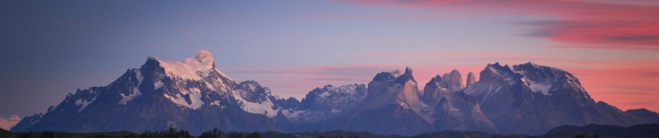
We would like to present Part 1 of the Gap Year. A 1102 km packrafthike in Norhern Sweden and Norway. All above the Arctic Circle, wider known as Lapland or Sápmi . 745km hiking. 357km packrafting. 55 days. Kick-off 25th July. Finale 17th September.
The first part includes passing through known and less known areas like Tromsdalen, the Lyngen Alps, Kitdalen, Breiddalen, packrafting Kummaeno, Taavaeno and Lainio in remote Northern Sweden, smashed in between Finland and Norway. A second part will bring us to the famous Kebnekaisefjällen in the Swedish fjells along the Kungsleden, packrafting south, passing a first time through Sarek, westwards through Padjalenta. There we will ferry towards Versteralen and Lofoten. Those islands sparked us with so much eager last year, that we had to come back for some packraft-floating in between the needle-like granite peaks emerging from the sea. We will ferry back towards mainland, from where we will traverse the Svartissen and Salfjellet National Parks in coastal Norway. We will cross back to Sweden in eastwards direction towards wildlife-cladden Taradalen, from where the ruska (autumn) coulours will daze us. From here we will enter a second time into Sarek with an intention on packrafting Rapadalen.
We expect subarctic, summer-autumn climate conditions : ****-loads of misty rain, snow, cold, low clouds on the windswept tundra, arctic mountains and a mosquito-laden taiga. Hopefully some sun too. Would be nice. Thank you.
Please click here for a google earth download file from the 55-day plan. We embed the map in google maps below, but google maps crops everything in 3 different pages, so you don’t have the full picture here.
We would appreciate it a lot, if people known to and from the area, and especially on packrafting some of the rivers, fjords or seas, if they could give us some feedback through the comments. Maybe we overexagerate on some (packrafting) parts of the plan. Or maybe we should reconsider alternatives, on which we did not set our eyes on. A gear list will appear here soon too.

Packrafthike Planning Lapland 2012

50 Days Food Rations Preperation
We known the area only from winter trips. We were on the Lofoten last year. Loads of pics will follow. We hope.
")
Utakleiv Beach – Lofoten Islands (from our april 2011 visit)
)")
Reine, probably the world’s most photoscenic village. Southern Lofoten Islands (from our april 2011 visit)


