“The real voyage of discovery consists not in seeking new landscapes, but in having new eyes.” ― Marcel Proust
“Black Saturday! Record traffic jams!” – howls the radio towards escapees for the French Riviera and Spanish costas. I almost fall asleep cruisin’ behind the wheel on our 1100km ride to Larvik, Denmark’s ferry harbour for Sweden and Norway. Everyday Robots on endless repeat. Clichés reign. Scandinavia isn’t beach dwellers dada.
The mountains are calling and I must go (J. Muir).
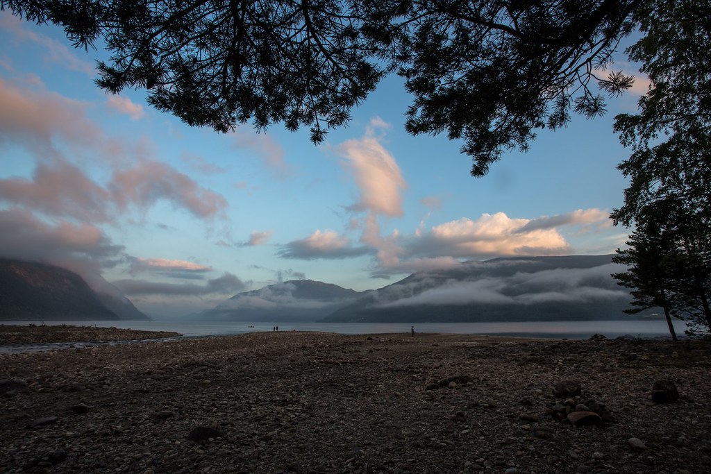
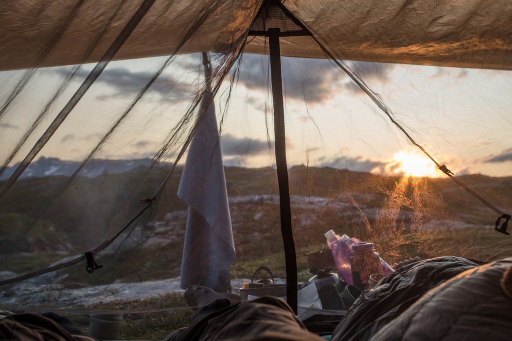
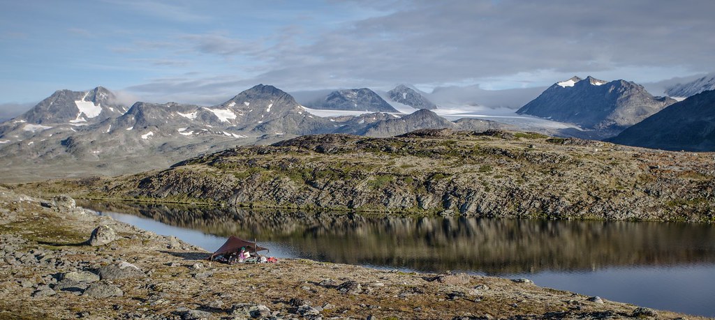
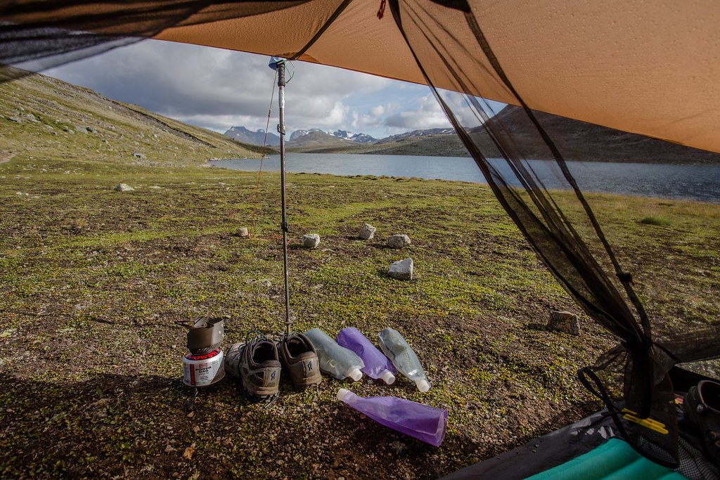
Bivaouc along Langvatnet.
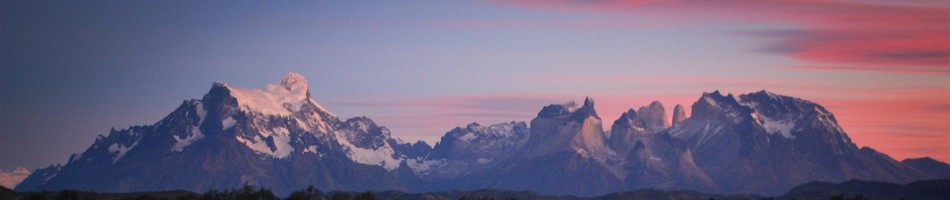
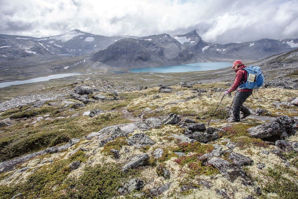
Jotunheimen NP. Norway.
We had a great 4 week thru-hike loop prepared for arctic Norway and Sweden looping from Bodø (Norway) to Ammarnäs (Sweden) and back to Mosjøen (Norway) through some promising wild country. Personal loss wiped those plans of the table. Trip cancelled. Black summer.
““When you feel life at crossroads, you need higher perspective view.” ― Toba Beta, My Ancestor Was an Ancient Astronaut
But as days and weeks passed by, we knew comfort would eventually steer us back into the mountains. We filled up the trunk with gear and food and travelled north. No plans. No maps. Zero expectations.
Tinnsjå (Tinnsjø, Lake Tinn) is one of the largest lakes in Norway, and one of the deepest (490m!) in Europe. Telemark county. Norway.
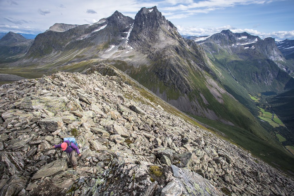
We knew southern Norway possesses limitless oportunities for spectacular mountain hiking and harbours accesible worldclass fjords. We soon enjoyed Scandinvian’s mild 2k14 summer . Eat. Sleep. Hike. A hassle free metronome.
The no plan trick was a revelation. Not surprisingly our camera was filled with happy memories from backpacking hikes in Hardangervidda, Sunnmøre , Reinheimen, Rondane and Jotunheimen.
“The future depends on what you do today.” Damn right Gandhi!
For those with 5 minutes to waste, we would like to invite you to hit play on our holiday video.
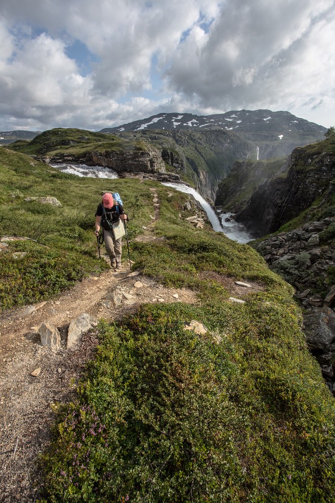
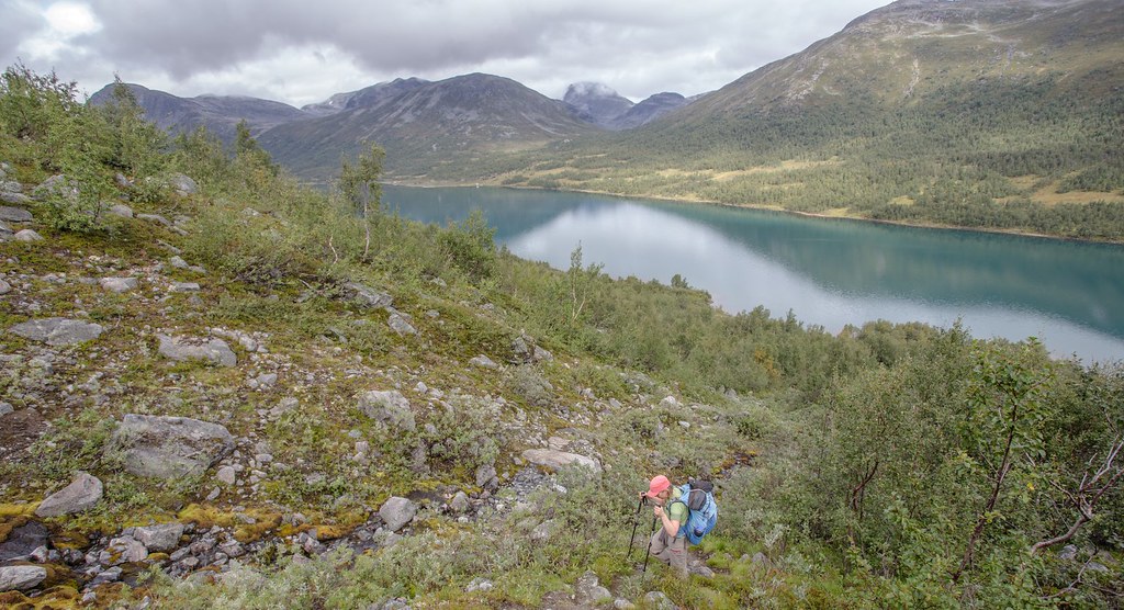
After a 800m climb up from the Hardangerfjord at sea level we finally arrive on the plateau.
Hardangervidda NP. Norway.
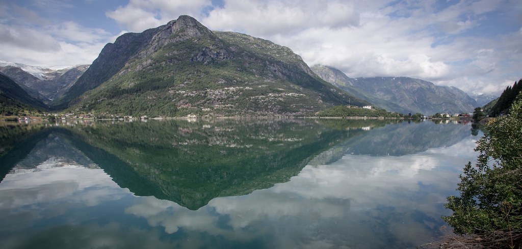
The Hardangerfjord is the third longest fjord in the world, and the second longest fjord in Norway. The fjord stretches 179 kilometres (111 mi) from the Atlantic Ocean into the mountainous interior of Norway along the Hardangervidda plateau. The innermost point of the fjord reaches the town of Odda.
The glaciers from the Folgefonna National Park almost drop into sea here.
Bivaouc on the edge of the Hardangervidda plateau, high above the Hardanger fjord. The plateau is the largest peneplain (eroded plain) in Europe, covering an area of about 6,500 km2 (2,500 sq mi) at an average elevation of 1,100 m (3,500 ft).
Inhaling the day’s last rays of light. The Oooknest from our faded MSR Twing Tarp perfectly fits under the MLD Trailstar (with some minor adaptions). Contrary to the expected we met little flying critters.
Hardangervidda NP. Norway.
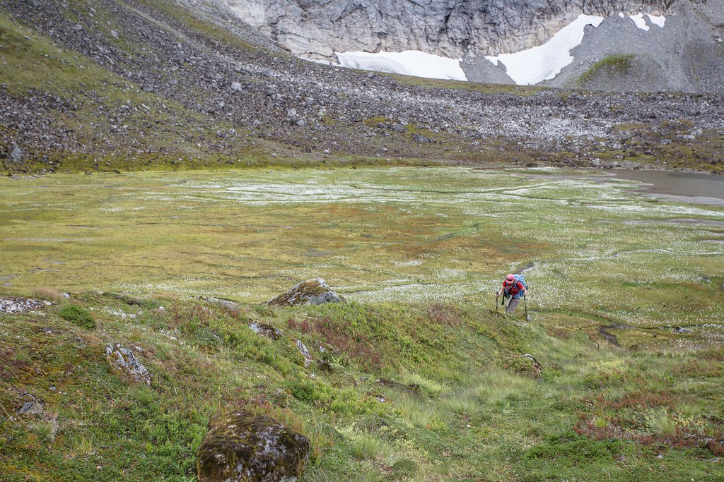
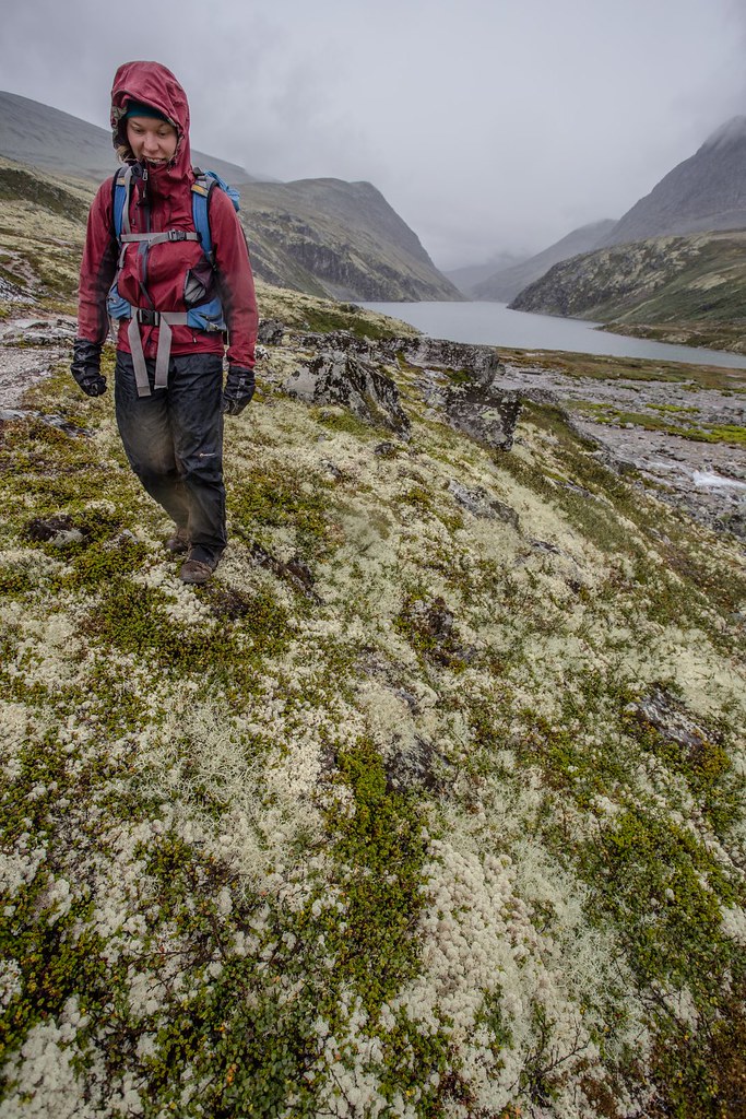
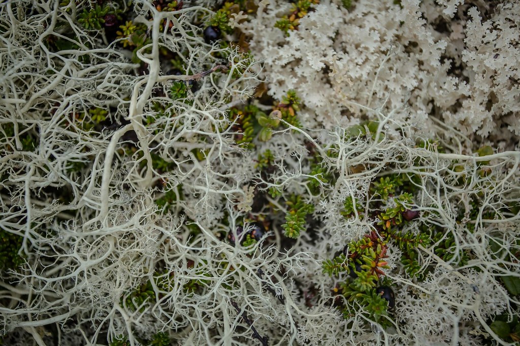
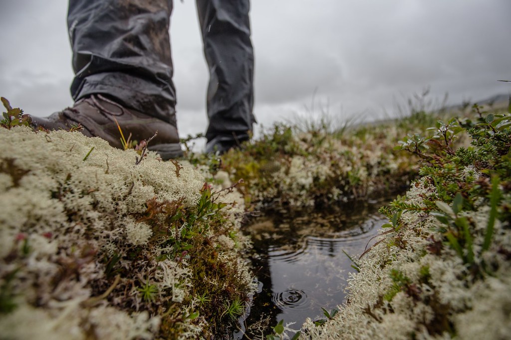
The varying climate of the plateau has a marked effect on the flora, which is richer on the wetter west side than in the drier east; much of the plateau is covered by coarse grasses, mosses (especially sphagnum) and lichens.
Hardangervidda NP.
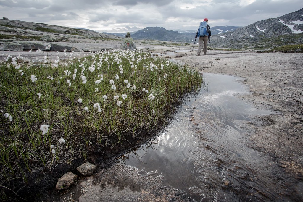
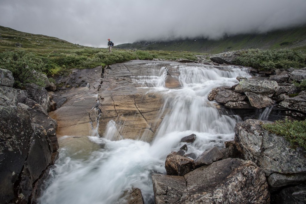
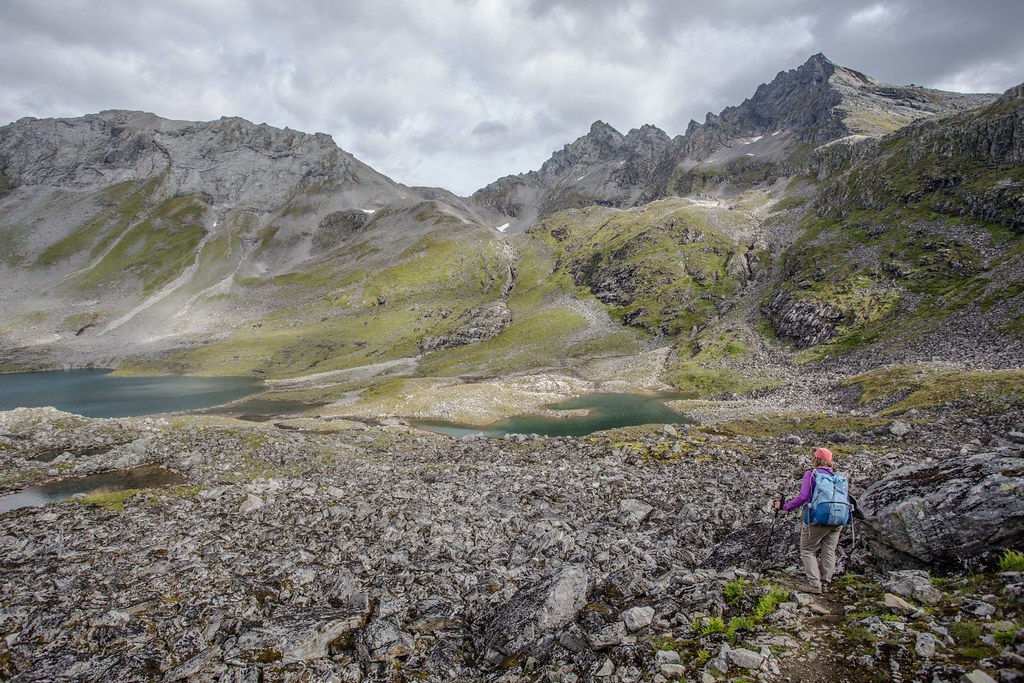
The landscape of the Hardangervidda is characterised by barren, treeless moorland interrupted by numerous pools, lakes, rivers and streams.
Hardangervidda NP. Norway.
Hardangervidda National Park, at 3,422 square kilometers, is Norway’s largest national park. It has the southernmost stock of several arctic animals and plants. Its wild reindeer herds are among the largest in the world. We didn’t met any. Probably something to do with the fact I should keep quiet a bit more often…
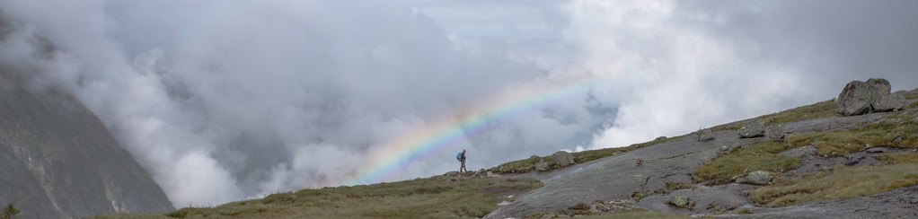
“You’ll never find a rainbow if you’re looking down”
― Charles Chaplin

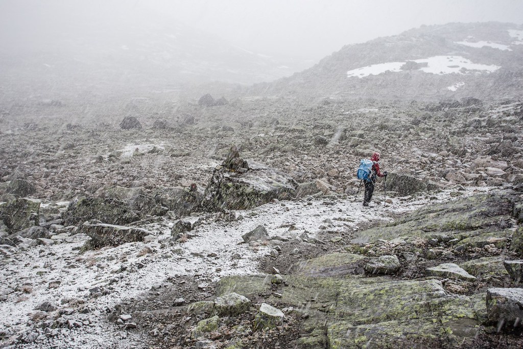
Walk. Slip. Stand. Try to walk again. Coccyx and slippery slab. No friends. Hardangervidda NP.
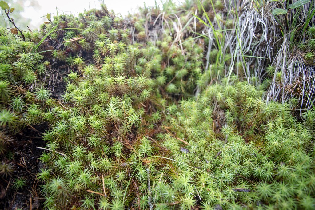
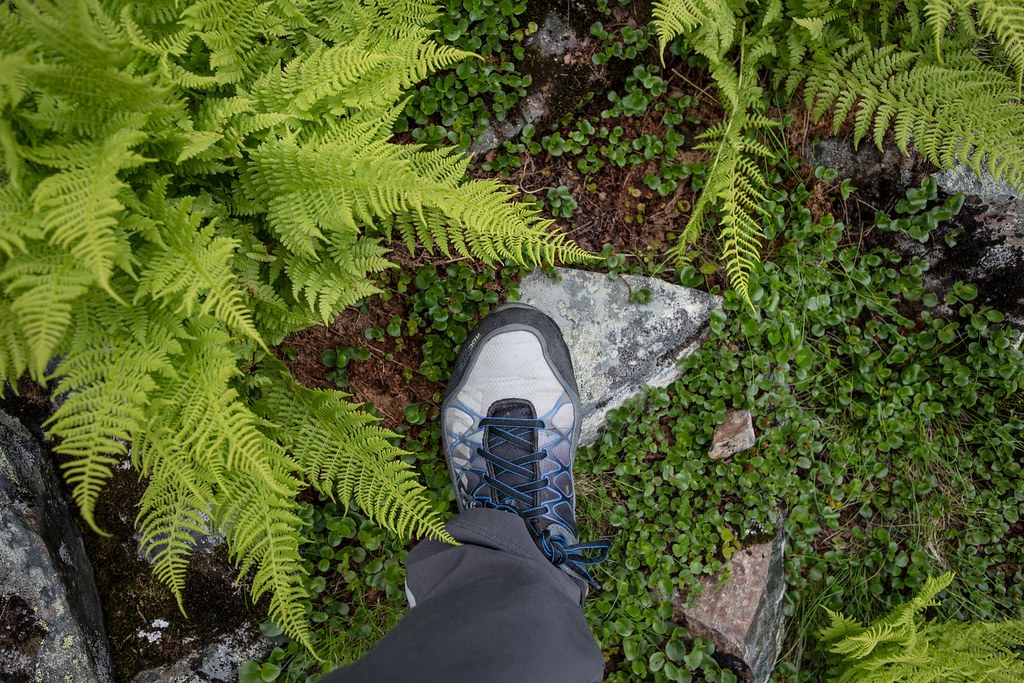
How can you resist the enchantingly microforrest around your toes. Hardangervidda NP. Norway.
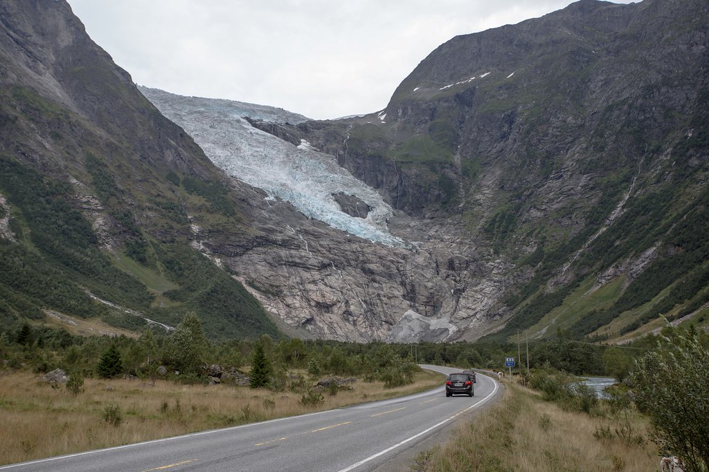
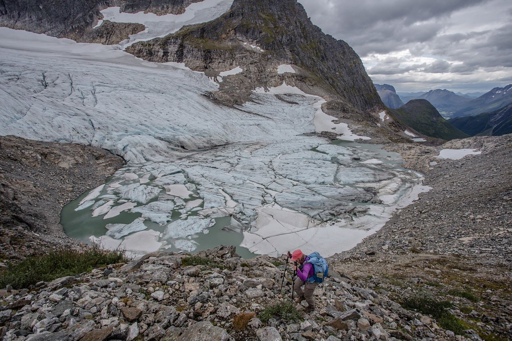
Jostedalsbreen is the largest glacier in continental Europe. It is situated in Sogn og Fjordane county in Western Norway. You can drive through it! Try it now before rock takes over blue ice.

Branches of the Jostedalsbreen glacier reach down into the valleys. The glacier is maintained by the high snowfall rates in the region, not the cold temperatures. This means the glacier has high melting rates in its snouts. The Jostedalsbreen has around 50 glacier arms such as the pictured Briksdalsbreen near Olden.
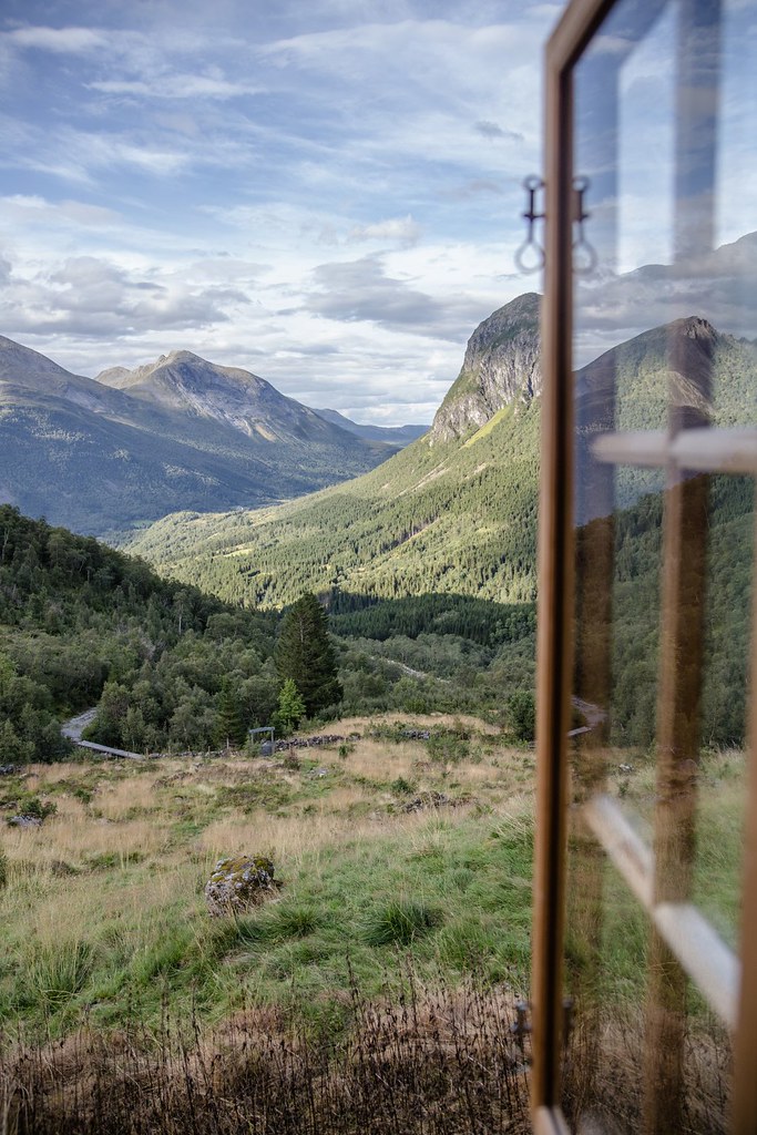
Awaiting friendly weahter in the comfy Patchellhytta. Sunnmøre Alps. Ålesund-Sunnmøre Turistforening.
Sunnmøre is the southern part of the county “Møre og Romsdal” near the Art Nouveau sea harbour of Ålesund on the west coast. of Norway It has numerous dramatic steep mountains fringing the fjords. These starkly beautiful region is often overlook by foreing mountain dwellers.
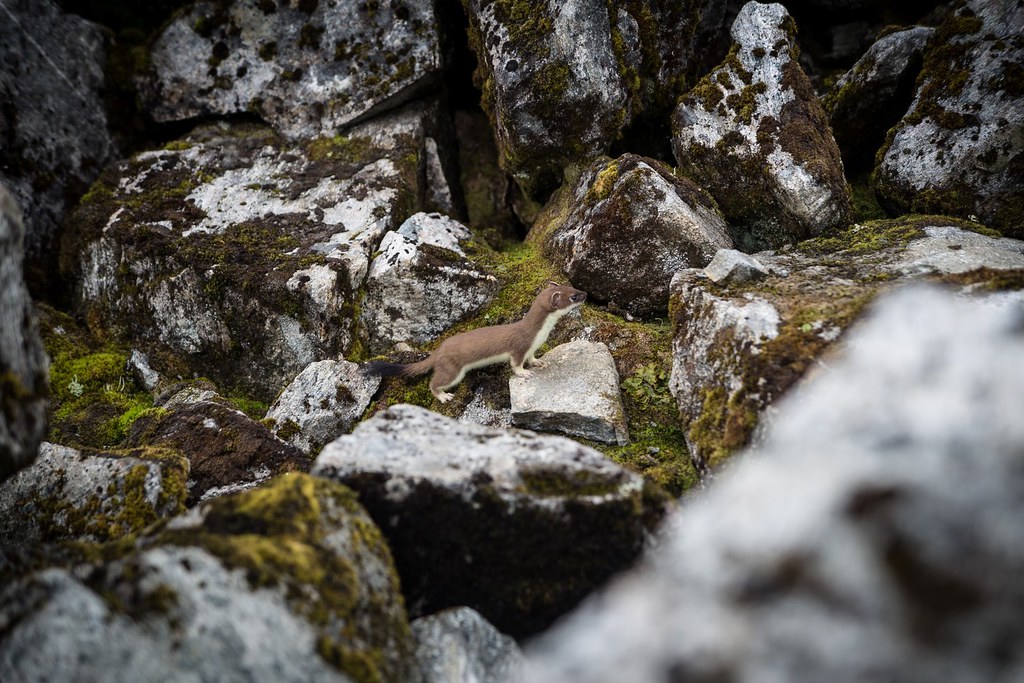
The curious case of the short-tailed weasel running in franzy over rock and fjell. On average, males measure 187–325 mm (7.4–12.8 in) in body length, while females measure 170–270 mm (6.7–10.6 in). To encounter a weasel when setting out for a journey was considered bad luck, but one could avert this by greeting the stoat as a neighbour, which I gladly did. A couple of hours later we climbed on the summit of Slogen, once desribed as the one of the proudest mountains in Europe.
Slogen is a mountain rising up from Hjørundfjorden. Even though it is not among the highest peaks in Norway, the 1,564-metre (5,131 ft) tall mountain is rated among the top ten mountain walks in Norway. This is largely due to its beauty, view, and the fact that it’s rising directly from the fjord. Sunnmøre Alps. Norway.
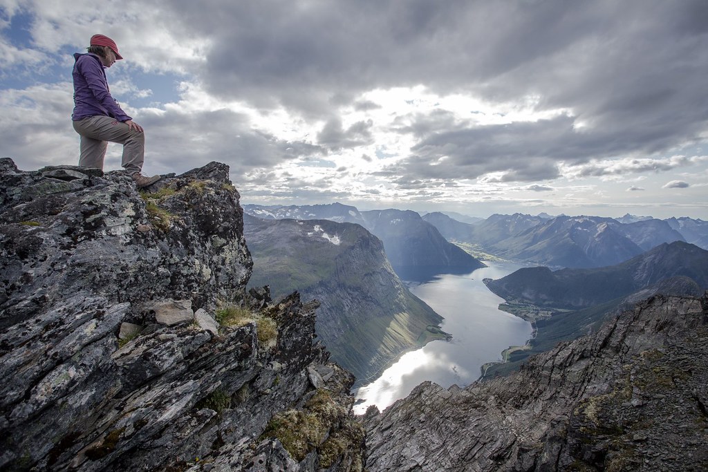
Peering one vertical mile down into Hjørundfjorden from the summit of 1,564-metre (5,131 ft) tall Slogen. A thrilling sight!
Isvatnet and Storevatnet lakes in the Langeseter valley with the pyramid Brekketinden summit rising above. Sunnmøre Alps. Norway.
Au soleil, sous la pluie,
à midi ou à minuit
il y a tout ce que vous voulez
aux Champs-Élysées.
Climb towards the alpine crossing between Gullmorebreen and Gullmoredalsvatnet. Sunnmøre Alps. Norway.
Bypassing the Gullmorbreen glacier right underneath Brekketindane (1578m). Sunnmøre Alps. Norway.
By this way we sincerely want to thank the Ålesund-Sunnmøre Turistforening for building and maintaining the Velleseter hytte. Probably the cosiest hytte in Southern Norway. Takk!
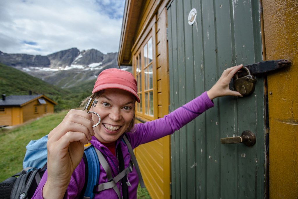
Happy backpacker with a key! Velleseter hytte. Sunnmøre Alps.
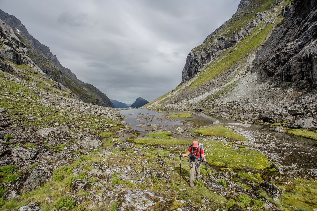
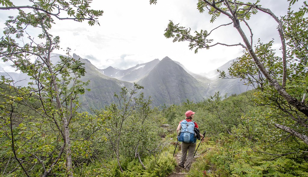
Crossing into Liadalen under a ray of sun. Sunnmøre Alps.
Ready for the 800m steep dive into the Norangsdalen. Sunnmøre Alps.
Geirangerfjord. A UNESCO World Heritage site. This fjord is surrounded by the steepest and, one is almost tempted to say, the most preposterous mountains on the entire west coast. It is very narrow and has no habitable shore area, for the precipitous heights rise in sheer and rugged strata almost straight out of the water. Foaming waterfalls plunge into the fjord from jagged peaks. Møre og Romsdal county, Norway.

The Troll Wall (Trollveggen) is the tallest vertical rock face in Europe, about 1,100 metres (3,600 ft) from its base to the summit of its highest point. At its steepest, the summit ridge overhangs the base of the wall by nearly 50 metres (160 ft). The Troll Wall has been a prestigious goal for climbers and base jumpers alike. Carl Boenish, the “father” of base jumping, was killed on the Troll Wall in 1984 shortly after setting the world record for the highest base jump in history. Base jumping from Troll Wall has been illegal since 1986, altough there are still illegal jumps almost every day. Basejumping. Nah. Let’s fish.
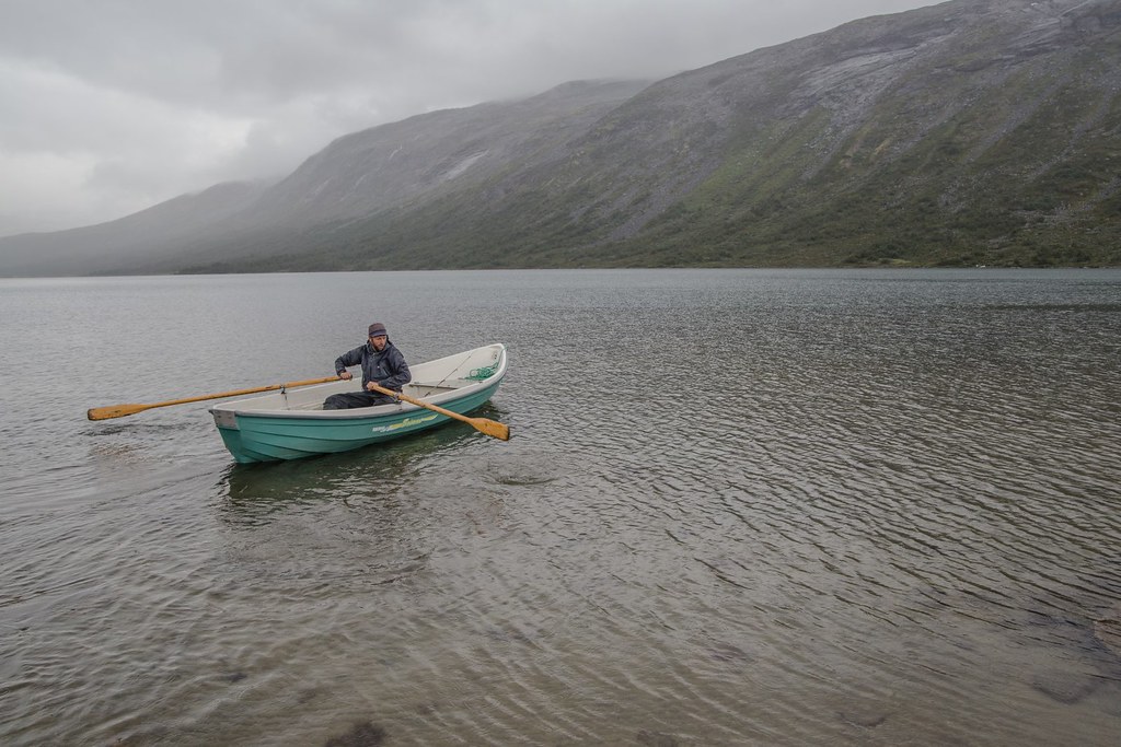
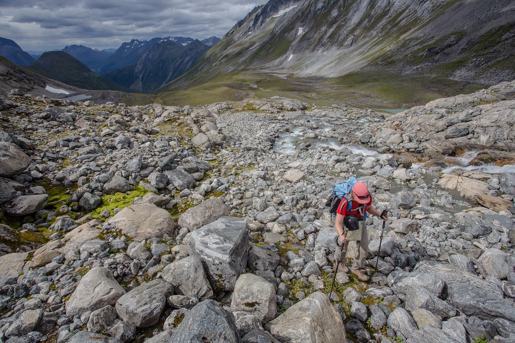
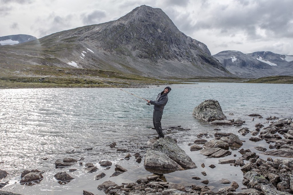
Gone for fishing on a fresh summer evening.. Ulvådalsvatnet lake. Tafjordfjellene. Reinheimen National Park. Oppland. Norway.
Hiking up to Hogtunga leaving Ulvådalsvatnet lake behind. Tafjordfjellene. Reinheimen National Park. Oppland. Norway.
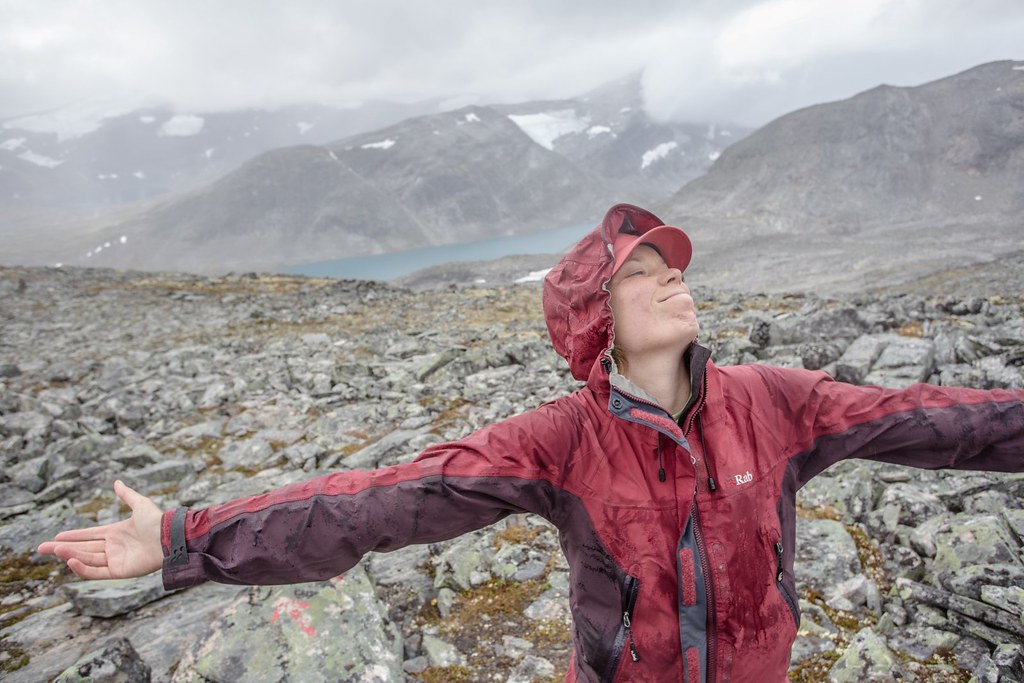
Rain on me! Enjoying prime summer weather in the Norwegian mountains. Tafjordfjellene. Reinheimen National Park. Oppland. Norway.
Incredible sollitude in the Tafjordfjellene mountains of Reinheimen National Park. Oppland. Norway.
Who needs the fish? Nodre Botvatnet. Tafjordfjellene. Reinheimen National Park. Oppland. Norway.
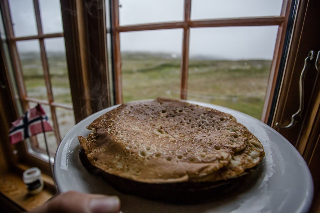
If there ain’t no fish to bite then let them pancakes taste. Pyttbua. Tafjordfjellene.
Reinheimen National Park. Oppland. Norway.
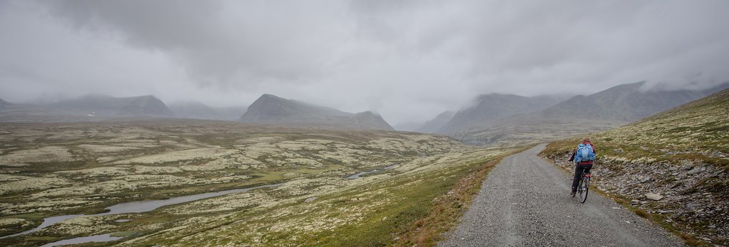
Real nice biking into Rondane NP on a rainy day. Hedmark and Oppland, Norway
Rondane is a typical high mountain area, with large plateaus and a total of ten peaks above 2,000 m (6,560 ft). The highest point is Rondeslottet (“The Rondane Castle”) at an altitude of 2,178 m (7,146 ft). The lowest point is just below the tree line, which is approximately 1,000 to 1,100 m (about 3,300 to 3,600 ft) above sea level. The climate is mild but relatively arid.
Mountain arteries. Rondane NP. Norway.
Apart from the White Birch trees of the lower areas, the soil and rocks are covered by heather and lichen, since they lack nutrients.
Rondane NP. Norway.
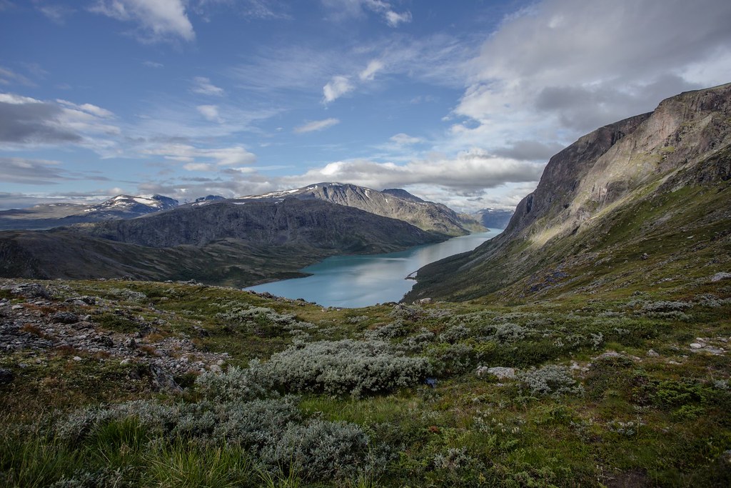
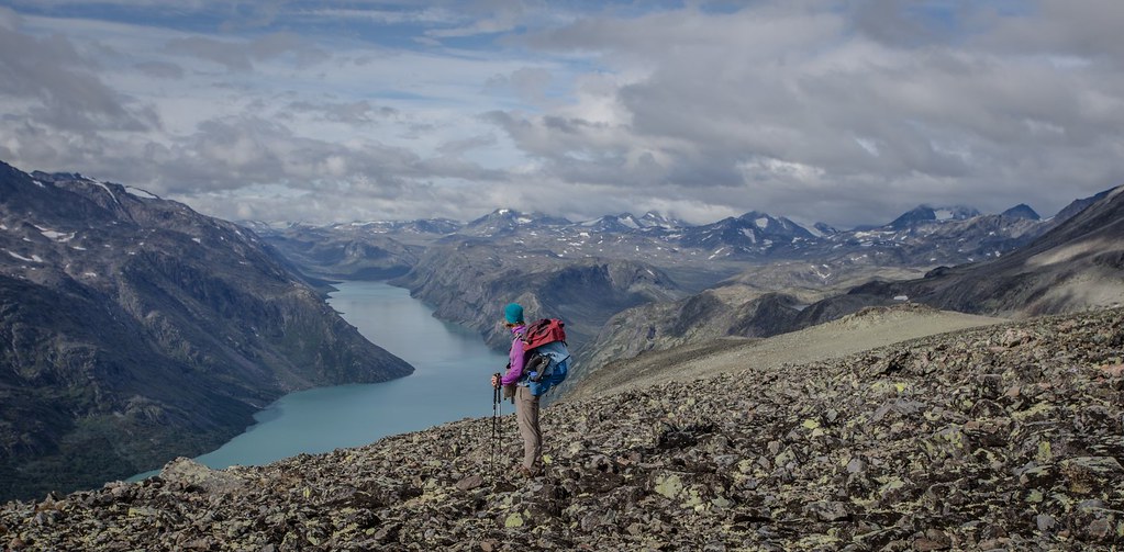
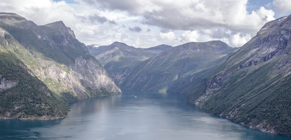
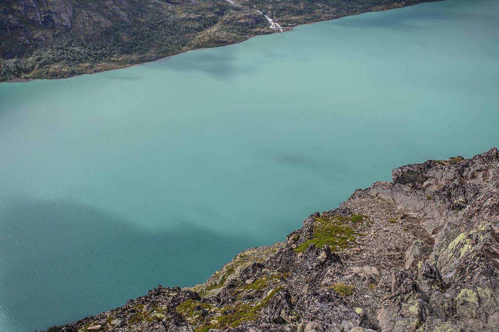
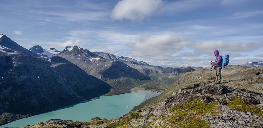
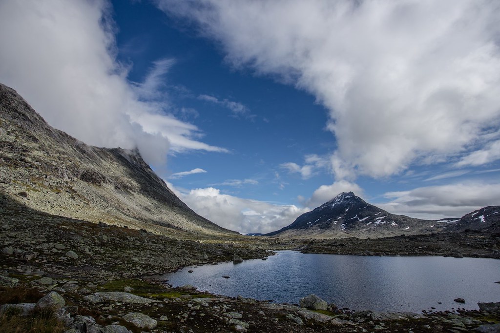
Morning view on Gjende lake. Jotunheimen (English: The Home of the Giants) is a mountainous area of roughly 3,500 km² in southern Norway and is part of the long range known as the Scandinavian Mountains. The 29 highest mountains in Norway are all in Jotunheimen, including the very highest – Galdhøpiggen (2469 m).
“The purest and most thoughtful minds are those which love color the most.”
― John Ruskin, The Stones of Venice
Jotunheimen contains Jotunheimen National Park, which was established in 1980 and covers an area of 1,151 km². Jotunheimen is very popular with hikers and climbers, and the Norwegian Mountain Touring Association maintains a number of mountain lodges in the area, as well as marked trails that run between the lodges and others that run up to some of the peaks.
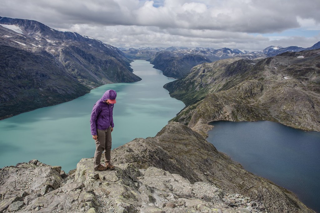
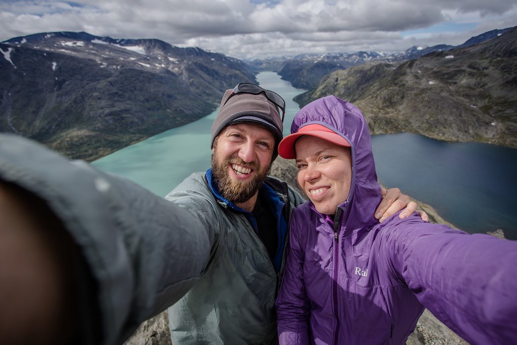
The walk over Besseggen ridge is one of the most popular mountain hikes in Norway. About 30,000 people walk this trip each year. From Besseggen there is a great view over azure Gjende (glacial) and dark Bessvatnet lake.
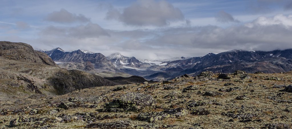
Jotunheimen NP. Norway.
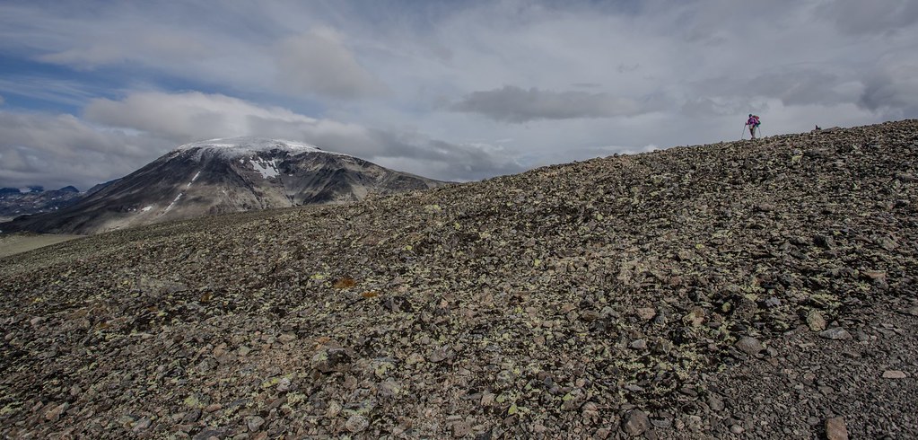
Rocks rock! Jotunheimen NP.
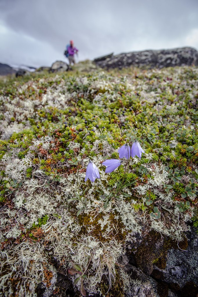
Harebell (Campanula rotundifolia). Jotunheimen NP.
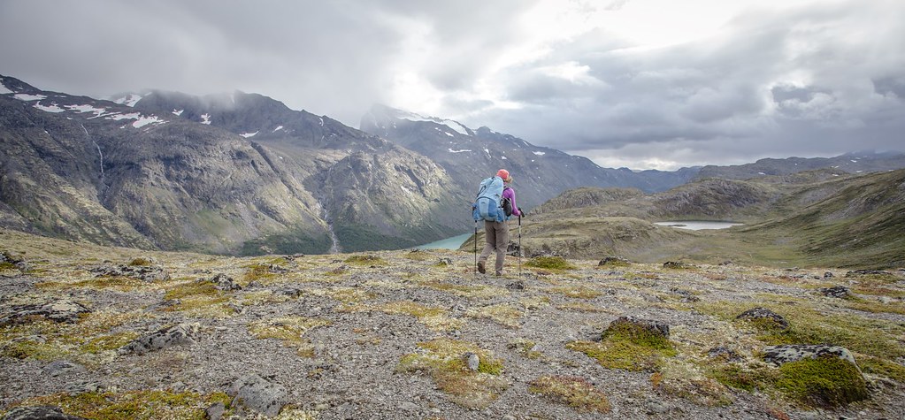
We hike because why wouldn’t we? Jotunheimen NP.
A painter’s dream. Memerutunga. Jotunheimen NP.
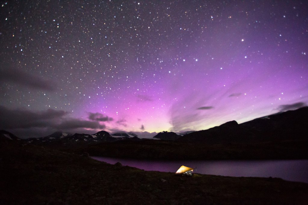
Flares from aurora borealis in the Norhern starsky. Memerutunga. Jotunheimen NP.
Nothing beats a coffee in the morning sun under the tarp. Memerutunga. Jotunheimen NP. Norway.
Gjendebu is the oldest cabin of the Norwegian Mountain Touring Association (DNT). The cabin lies 995 metres above sea level, by the western end of the lake Gjende, central in Jotunheimen. It is accessible by hiking along marked trails, or by boat over Gjende from Gjendesheim. The cabin was built in 1871 and was at that time 45 m² and with 12 beds, today there are 119 beds.
Memerutunga. Jotunheimen NP.
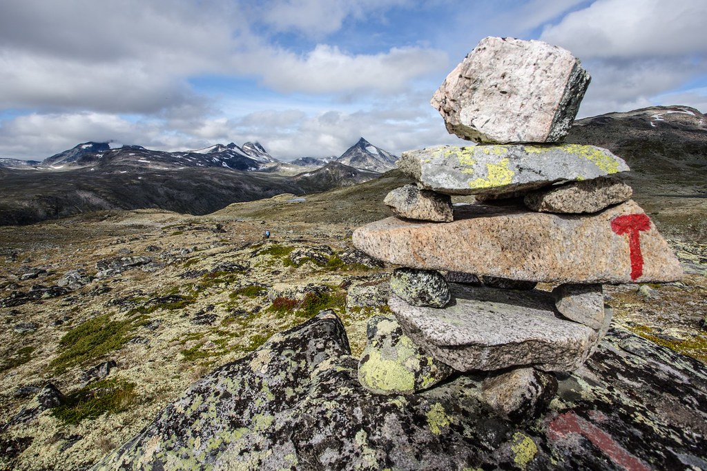
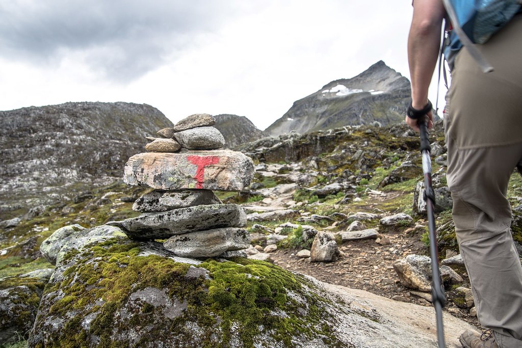
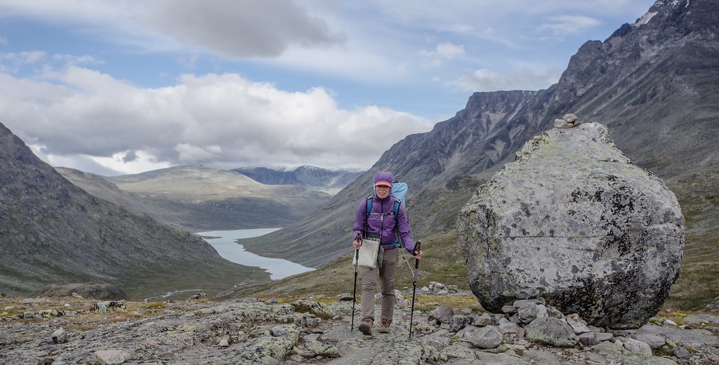
Around 400km of marked hiking trails and routes can be found in Jotunheimen. They are maintained by the Norwegian Trekking Association which marks cairns and rocks with the famous red T.
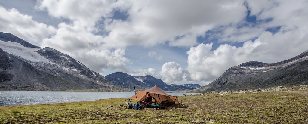
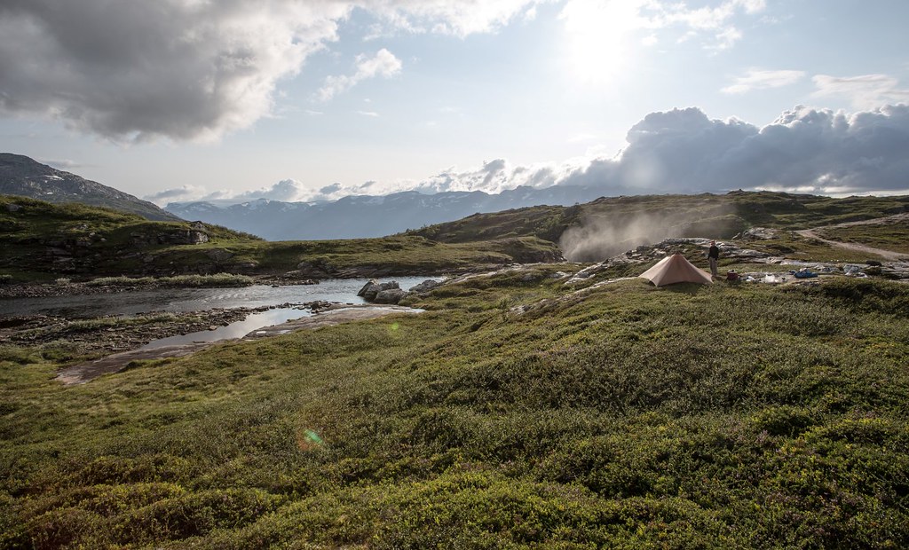
Room with a view. Langvatnet. Jotuheimen NP.

Urdadola runs into Langvatnet. Dusk. Jotunheimen NP.
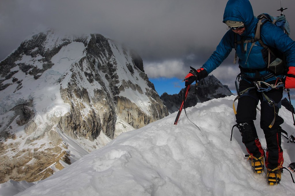
Despite it’s moderate altitude in comparison with other mountain ranges, northern latitude give Jotunheimen typical high alpine climate. Gulf stream bring lots of precipitation that is released especially on the western parts of Jotunheimen. Rapid weather changes are possible and winter conditions are not impossible even in the middle of summer.
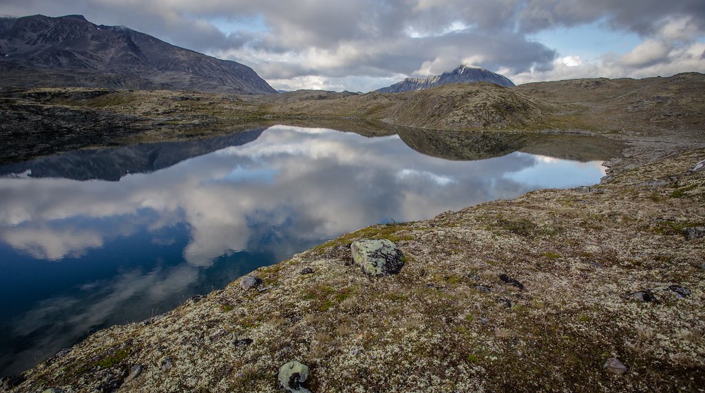
Jotunheimen NP.
Snoholtinden as seen from Olavsbu, Jotunheimen NP.
It’s been a while since the last blogpost so thanks a lot for your patience.